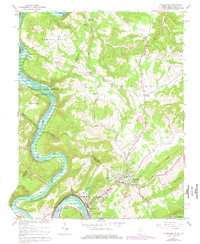
1965 Map of Peterstown
USGS Topo · Published 1977About this map
Bluestone Lake dominates the western corridor of this quadrangle, where the New River winds through the borderlands of West Virginia and Virginia. The 1960s landscape shows a transition between the water-recreation areas of the Sherman Ballard Recreation Area and the rugged upland ridges of Peters Mtn and Chimney Ridge. The town of Peterstown serves as a local hub near the southern edge, connected to the industrial movement of the Norfolk and Western railroad which skirts the banks of Rich Creek.
Find a feature on this map
54 named features on this map. Tap any name to fly to it.
Don’t see what you’re looking for? This feature index may not catch every label — zoom into the map to look around manually.
Map Details
Editions of this 1965 Peterstown Map
Other maps of this area

1887 · Hinton
USGS Topo · 1:125,000

1890 · Dublin
USGS Topo · 1:125,000

1891 · Dublin
USGS Topo · 1:125,000

1892 · Hinton
USGS Topo · 1:125,000

1912 · Big Bend
USGS Topo · 1:62,500

1913 · Peterstown
USGS Topo · 1:48,000

1914 · Big Bend
USGS Topo · 1:62,500

1916 · Peterstown
USGS Topo · 1:62,500

1921 · Alderson
USGS Topo · 1:48,000

1923 · Pearisburg
USGS Topo · 1:62,500