Loading...
Loading map...2021 Map of Oasis
USGS Topo · Published 2021About this map
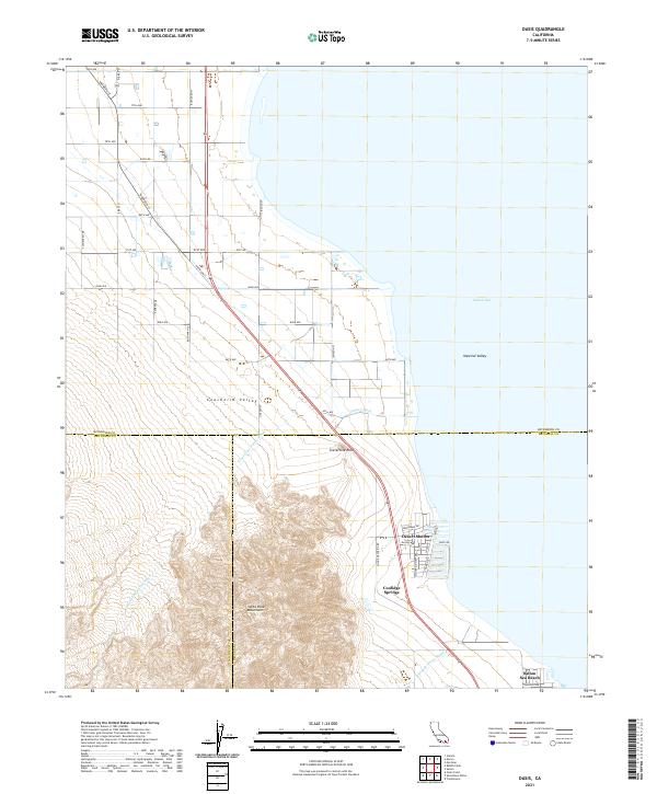
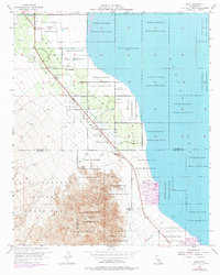
Desert Shores and Salton Sea Beach occupy the narrow strip of land where the eastern foothills of the Santa Rosa Mountains meet the northwestern edge of the Salton Sea. This desert landscape is defined by the convergence of the Coachella Valley and the Imperial Valley, showing a complex transition from high-elevation ridgelines down to the shore. A triple-county boundary line marks a specific point of intersection for Riverside, San Diego, and Imperial counties.
Find a feature on this map
44 named features on this map. Tap any name to fly to it.
Don’t see what you’re looking for? This feature index may not catch every label — zoom into the map to look around manually.
Map Details
Date Portrayed2021
Date Published2021
PublisherU.S. Geological Survey
Map TypeTopographic
Scale1:24000
Physical Dimensions24 x 29 inches
Editions of this 2021 Oasis Map
This is the sole edition of this map. No revisions or reprints were ever made.
Historical Maps of Desert Shores Through Time
Featured Locations
Source Details
SourceU.S. Geological Survey
CopyrightPublic Domain