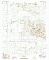
1986 Map of Oatman Mountain
USGS Topo · Published 1986About this map
Oatman Mountain dominates the eastern half of this landscape, rising above the Hyder Valley and the southern Gila River corridor. The river bottom is a center of human activity, featuring the broad Oatman Flat and a series of agricultural and industrial developments including a ditch and a Gravel Pit. Settlement is sparse, anchored by Montezuma in the northwest and a few scattered structures such as a Corral and Radio Towers atop the peaks.
Find a feature on this map
18 named features on this map. Tap any name to fly to it.
Don’t see what you’re looking for? This feature index may not catch every label — zoom into the map to look around manually.
Map Details
Editions of this 1986 Oatman Mountain Map
This is the sole edition of this map. No revisions or reprints were ever made.
Other maps of this area

1927 · Hyder
USGS Topo · 1:62,500

1929 · Aztec
USGS Topo · 1:62,500

1930 · Hyder
USGS Topo · 1:62,500

1942 · Vicksburg
USGS Topo · 1:250,000

1949 · Sentinel
USGS Topo · 1:62,500

1950 · Sentinel
USGS Topo · 1:62,500

1950 · Aztec
USGS Topo · 1:62,500

1951 · Dendora Valley
USGS Topo · 1:62,500

1953 · Ajo
USGS Topo · 1:250,000

1954 · Phoenix
USGS Topo · 1:250,000