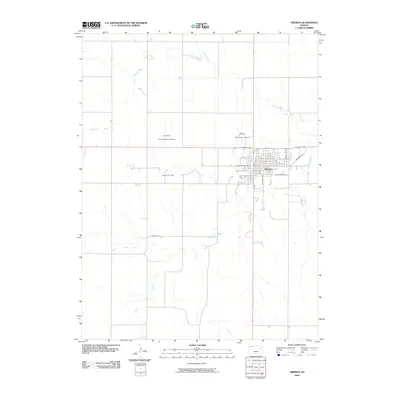
2009 Map of Oberlin
USGS Topo · Published 2009About this map
Oberlin serves as the focal point of this Northwest Kansas landscape, situated at the confluence of several watercourses including Sappa Creek and the North Fork Sappa Creek. The town's grid is anchored by routes such as W Frontier Pkwy and S Penn Ave, reflecting its role as a regional hub for the surrounding agricultural prairie. Evidence of the local economy is visible in the presence of aviation and energy infrastructure, notably the Pollnow Oil Field and the R and D Aerial Spraying Airport. The terrain is defined by the gradual drainage of the High Plains, where Johnson Draw feeds into the creek system. This 2009 survey highlights a community balancing traditional land use with modern developments like the Oberlin Municipal Airport, providing a clear view of the town's footprint before later 21st-century changes.
Find a feature on this map
16 named features on this map. Tap any name to fly to it.
Don’t see what you’re looking for? This feature index may not catch every label — zoom into the map to look around manually.
Map Details
Editions of this 2009 Oberlin Map
This is the sole edition of this map. No revisions or reprints were ever made.
Other maps of this area

1951 · Selden
USGS Topo · 1:62,500

1951 · Oberlin
USGS Topo · 1:62,500

1951 · Kanona
USGS Topo · 1:62,500

1954 · Goodland
USGS Topo · 1:250,000

1956 · Goodland
USGS Topo · 1:250,000

1957 · Goodland
USGS Topo · 1:250,000

1965 · Oberlin
USGS Topo · 1:24,000

1965 · Kanona
USGS Topo · 1:24,000

1965 · Oberlin SW
USGS Topo · 1:24,000
1965 · Kanona NW
USGS Topo · 1:24,000