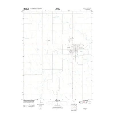
2012 Map of Oberlin
USGS Topo · Published 2012About this map
Oberlin serves as a vital agricultural and civic hub in Decatur County, situated at the confluence of several regional waterways. The landscape is defined by the winding paths of Sappa Cr and the S Fork Sappa Cr, which converge near the town center. The community's infrastructure is well-established, featuring the Decatur County Fairgrounds and the Oberlin Speedway on its western edge. To the north, the Oberlin Municipal Airport and Shaw Aerial Spraying Airport highlight the importance of aviation to local commerce and farming.
Find a feature on this map
25 named features on this map. Tap any name to fly to it.
Don’t see what you’re looking for? This feature index may not catch every label — zoom into the map to look around manually.
Map Details
Editions of this 2012 Oberlin Map
This is the sole edition of this map. No revisions or reprints were ever made.
Other maps of this area

1951 · Selden
USGS Topo · 1:62,500

1951 · Oberlin
USGS Topo · 1:62,500

1951 · Kanona
USGS Topo · 1:62,500

1954 · Goodland
USGS Topo · 1:250,000

1956 · Goodland
USGS Topo · 1:250,000

1957 · Goodland
USGS Topo · 1:250,000

1965 · Oberlin
USGS Topo · 1:24,000

1965 · Kanona
USGS Topo · 1:24,000

1965 · Oberlin SW
USGS Topo · 1:24,000
1965 · Kanona NW
USGS Topo · 1:24,000