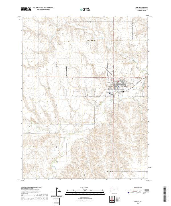
2022 Map of Oberlin
USGS Topo · Published 2022About this map
Oberlin serves as the focal point of this Decatur County landscape, situated where several branches of the Sappa Creek drainage system converge. The town's grid is clearly defined by local thoroughfares such as W Commercial St and E Victoria St, which extend toward the surrounding agricultural lands. The importance of aviation to this rural economy is evident through the presence of both the Oberlin Municipal Airport and the specialized Shaw Aerial Spraying Airport to the northwest. Beyond the residential center, the terrain is shaped by the winding courses of Sappa Cr and its tributaries, including the N Fork Sappa Cr and S Fork Sappa Cr. On the northeastern edge of town, the Oberlin Cem remains a significant landmark for those tracing local family history and the development of the settlement over time.
Find a feature on this map
46 named features on this map. Tap any name to fly to it.
Don’t see what you’re looking for? This feature index may not catch every label — zoom into the map to look around manually.
Map Details
Editions of this 2022 Oberlin Map
This is the sole edition of this map. No revisions or reprints were ever made.
Other maps of this area

1951 · Selden
USGS Topo · 1:62,500

1951 · Oberlin
USGS Topo · 1:62,500

1951 · Kanona
USGS Topo · 1:62,500

1954 · Goodland
USGS Topo · 1:250,000

1956 · Goodland
USGS Topo · 1:250,000

1957 · Goodland
USGS Topo · 1:250,000

1965 · Oberlin
USGS Topo · 1:24,000

1965 · Kanona
USGS Topo · 1:24,000

1965 · Oberlin SW
USGS Topo · 1:24,000
1965 · Kanona NW
USGS Topo · 1:24,000