
1965 Map of Oberlin
USGS Topo · Published 1966About this map
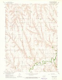
Oberlin serves as the focal point of this mid-1960s survey, situated at the confluence where the North Fork Sappa Creek and South Fork Sappa Creek merge to form Sappa Creek. The town's infrastructure reflects its role as a regional hub, featuring the Oberlin Municipal Airport, a Hospital, and the local Fairground. Local education and community life are anchored by the High Sch and several civic landmarks, including the Po and Cem.
Find a feature on this map
24 named features on this map. Tap any name to fly to it.
Don’t see what you’re looking for? This feature index may not catch every label — zoom into the map to look around manually.
Map Details
Editions of this 1965 Oberlin Map
This is the sole edition of this map. No revisions or reprints were ever made.
Other maps of this area

1951 · Selden
USGS Topo · 1:62,500

1951 · Oberlin
USGS Topo · 1:62,500

1951 · Kanona
USGS Topo · 1:62,500

1954 · Goodland
USGS Topo · 1:250,000

1956 · Goodland
USGS Topo · 1:250,000

1957 · Goodland
USGS Topo · 1:250,000

1965 · Kanona
USGS Topo · 1:24,000

1965 · Oberlin SW
USGS Topo · 1:24,000
1965 · Kanona NW
USGS Topo · 1:24,000

1965 · Selden NW
USGS Topo · 1:24,000