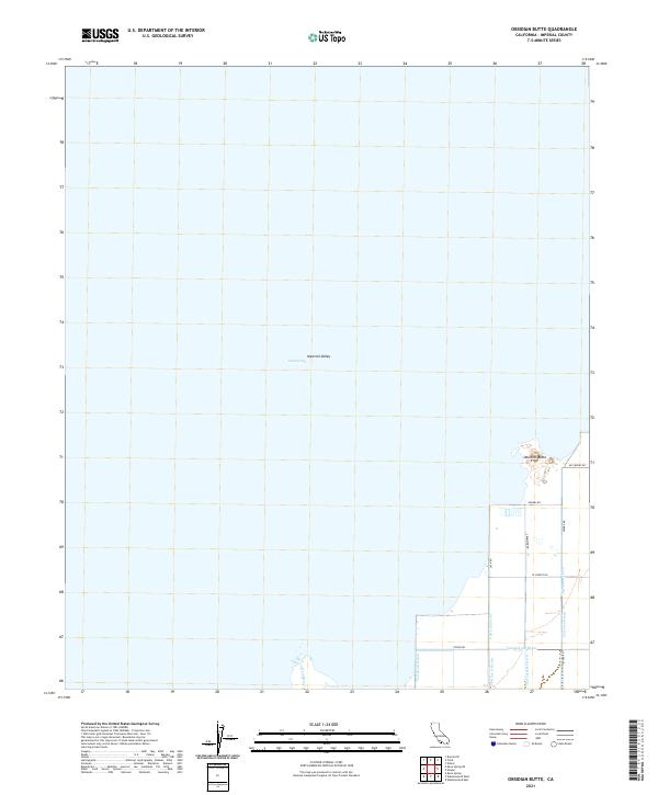
2021 Map of Obsidian Butte
USGS Topo · Published 2021About this map
Obsidian Butte stands as a distinct landmark within the expansive Imperial Valley landscape, positioned near the southeastern shoreline of the Salton Sea. This area is defined by a sophisticated network of agricultural water management features, including the New River and various specialized channels such as the Vail Seven Drain and Vail Cut-Off Drain. The map reveals the precise grid of the region's land management, with roads like Young Rd and Lack Rd providing access across the low-lying terrain. The transition between the open waters of the sea and the structured irrigation system of the valley illustrates the intensive modification of the desert environment for agricultural use in the twenty-first century.
Find a feature on this map
23 named features on this map. Tap any name to fly to it.
Don’t see what you’re looking for? This feature index may not catch every label — zoom into the map to look around manually.
Map Details
Editions of this 2021 Obsidian Butte Map
This is the sole edition of this map. No revisions or reprints were ever made.
Other maps of this area

1940 · Kane Spring
USGS Topo · 1:62,500

1940 · Frink
USGS Topo · 1:62,500

1940 · Durmid
USGS Topo · 1:62,500

1944 · Durmid
USGS Topo · 1:62,500

1944 · Kane Spring
USGS Topo · 1:62,500

1944 · Calipatria
USGS Topo · 1:62,500

1944 · Frink
USGS Topo · 1:62,500

1954 · Salton Sea
USGS Topo · 1:250,000

1955 · Salton Sea
USGS Topo · 1:250,000
1956 · Durmid SE
USGS Topo · 1:24,000