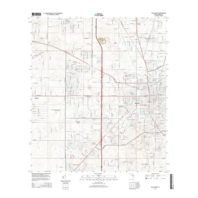
2015 Map of Ocala West
USGS Topo · Published 2015About this map
The western periphery of Ocala displays a landscape defined by rapid suburban expansion and institutional growth in this 2015 record. Centered on the sprawling Ocala International Airport-Jim Taylor Field, the map reveals a corridor of higher education and memorial parks. Central Florida Community Coll and Rasmussen College-Ocala sit amidst a grid of residential developments like Tree Village, while the western edge transitions toward the settlement of Martel. Genealogists will find a high density of burial grounds including Evergreen Cem, Lincoln Memorial Gardens of Ocala, and several smaller historic sites such as Mount Tabor Cem. The map also captures the local hydrography with features like Scott Spring and Lake Louise interspersed between the growing commercial and residential infrastructure of Marion County.
Find a feature on this map
170 named features on this map. Tap any name to fly to it.
Don’t see what you’re looking for? This feature index may not catch every label — zoom into the map to look around manually.
Map Details
Editions of this 2015 Ocala West Map
This is the sole edition of this map. No revisions or reprints were ever made.
Other maps of this area

1892 · Dunnellon
USGS Topo · 1:62,500

1893 · Citra
USGS Topo · 1:62,500

1894 · Dunnellon
USGS Topo · 1:62,500

1895 · Williston
USGS Topo · 1:62,500

1895 · Citra
USGS Topo · 1:62,500

1895 · Ocala
USGS Topo · 1:62,500

1954 · Cotton Plant
USGS Topo · 1:24,000

1954 · Dunnellon SE
USGS Topo · 1:24,000

1954 · Dunnellon
USGS Topo · 1:62,500

1954 · Gainesville
USGS Topo · 1:250,000