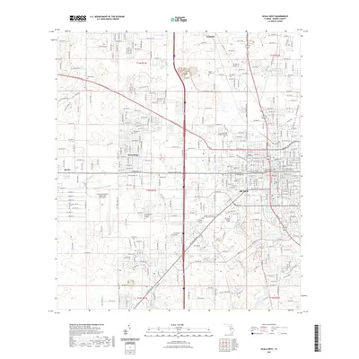
2021 Map of Ocala West
USGS Topo · Published 2021About this map
Ocala serves as the focal point of this 2021 survey, revealing a landscape defined by significant institutional and commemorative sites. The western reaches of the city are anchored by the Ocala International Airport-Jim Taylor Field, while the downtown core is marked by the Marion County Judicial Center. This edition documents a high concentration of historic burial grounds and memorial parks, ranging from the Lincoln Memorial Gardens of Ocala to smaller sites like Carter Cem and Mount Tabor Cem. Educational growth is evident through several campuses, including the College of Central Florida and Rasmussen College - Ocala. Natural hydrology persists amidst the development, with Scott Spring and Lake Louise providing distinct breaks in the residential grid of Ocala Ridge.
Find a feature on this map
187 named features on this map. Tap any name to fly to it.
Don’t see what you’re looking for? This feature index may not catch every label — zoom into the map to look around manually.
Map Details
Editions of this 2021 Ocala West Map
This is the sole edition of this map. No revisions or reprints were ever made.
Other maps of this area

1892 · Dunnellon
USGS Topo · 1:62,500

1893 · Citra
USGS Topo · 1:62,500

1894 · Dunnellon
USGS Topo · 1:62,500

1895 · Williston
USGS Topo · 1:62,500

1895 · Citra
USGS Topo · 1:62,500

1895 · Ocala
USGS Topo · 1:62,500

1954 · Cotton Plant
USGS Topo · 1:24,000

1954 · Dunnellon SE
USGS Topo · 1:24,000

1954 · Dunnellon
USGS Topo · 1:62,500

1954 · Gainesville
USGS Topo · 1:250,000