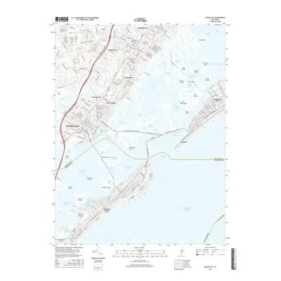
2016 Map of Ocean City
USGS Topo · Published 2016About this map
Somers Point and Margate City dominate this coastal landscape, separated by the intricate tidal waters of Steelman Bay and Broad Thorofare. The map details the transition from the mainland settlements of Linwood and Northfield to the barrier island community of Ocean City. A dense network of local roads and the Garden State Parkway connect these shoreline hubs, while the Ocean City Municipal Airport occupies a prominent position on the western edge of the southern island.
Find a feature on this map
112 named features on this map. Tap any name to fly to it.
Don’t see what you’re looking for? This feature index may not catch every label — zoom into the map to look around manually.
Map Details
Editions of this 2016 Ocean City Map
This is the sole edition of this map. No revisions or reprints were ever made.
Other maps of this area

1884 · Sea Isle
USGS Topo · 1:62,500

1887 · Atlantic City
USGS Topo · 1:62,500

1888 · Sea Isle
USGS Topo · 1:62,500

1890 · Great Egg Harbor
USGS Topo · 1:62,500

1893 · Great Egg Harbor
USGS Topo · 1:62,500

1894 · Sea Isle
USGS Topo · 1:62,500

1894 · Atlantic City
USGS Topo · 1:62,500

1918 · Great Egg Harbor
USGS Topo · 1:62,500

1919 · Sea Isle
USGS Topo · 1:62,500

1940 · Atlantic City
USGS Topo · 1:62,500