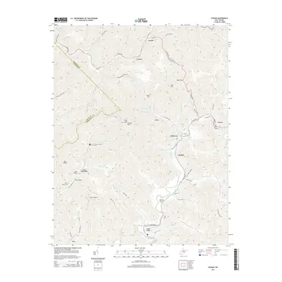
2014 Map of Oceana
USGS Topo · Published 2014About this map
Oceana anchors the eastern edge of this landscape, where the confluence of Clear Fork and Dingess Fork defines the local topography. This 2014 survey captures the intricate drainage system of Wyoming and Logan Counties, marked by dozens of named hollows and branches that feed into the larger creek systems. Steep ridges like Huff Mtn and Blue Ridge separate scattered communities such as Cyclone, Lynco, and Coal Mountain. The presence of the Burning Rock Lookout Tower atop Burning Rock highlights a high-elevation vantage point overlooking the winding creek valleys. Genealogists and local historians will find value in family-associated landmarks like the Milty T Morgan Cem and the Upper Sturgeon Br church. The map also illustrates the transition of land use from the traditional Appalachian hollows to modern recreation at the Clear Fork Valley Golf Course and industrial features like Lynco Number Two Lake.
Find a feature on this map
82 named features on this map. Tap any name to fly to it.
Don’t see what you’re looking for? This feature index may not catch every label — zoom into the map to look around manually.
Map Details
Editions of this 2014 Oceana Map
This is the sole edition of this map. No revisions or reprints were ever made.
Other maps of this area

1891 · Oceana
USGS Topo · 1:125,000

1893 · Oceana
USGS Topo · 1:125,000

1898 · Oceana
USGS Topo · 1:125,000

1909 · Gilbert
USGS Topo · 1:48,000

1910 · Pineville
USGS Topo · 1:48,000

1910 · Bald Knob
USGS Topo · 1:48,000

1912 · Bald Knob
USGS Topo · 1:62,500

1912 · Gilbert
USGS Topo · 1:62,500

1912 · Pineville
USGS Topo · 1:62,500

1913 · Logan
USGS Topo · 1:62,500