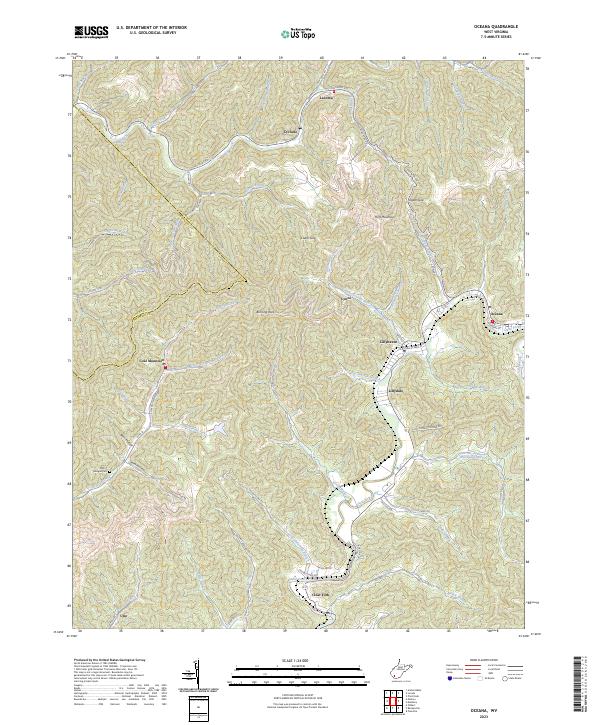
2023 Map of Oceana
USGS Topo · Published 2023About this map
Oceana and the surrounding hollows of Wyoming County are defined by a landscape of tight ridges and narrow stream valleys where settlements cling to the available level ground. The confluence of Clear Fork and several mountain branches supports a string of communities including Lillyhaven, Lillydale, and Lynco. To the west, the village of Coal Mountain sits atop the high ground near the Logan County line, an area marked by industrial footprints and the Strip Mine Rd. Historical traces like the Milty T Morgan Cem near Big Cub Creek offer specific points of interest for genealogists tracking family roots in these coalfields. The geography is dictated by named peaks and passages such as Huff Mountain and Burning Rock, which channel local travel along corridors like Huff Creek Rd and Toler Hollow Rd.
Find a feature on this map
79 named features on this map. Tap any name to fly to it.
Don’t see what you’re looking for? This feature index may not catch every label — zoom into the map to look around manually.
Map Details
Editions of this 2023 Oceana Map
This is the sole edition of this map. No revisions or reprints were ever made.
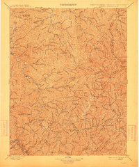
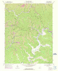
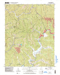
Historical Maps of Uno Through Time
6 maps found