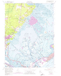
1952 Map of Oceanville
USGS Topo · Published 1973About this map
Brigantine National Wildlife Refuge dominates the eastern coastal reaches of this survey, protecting a complex network of salt marshes and tidal channels like Main Marsh Thorofare and Big Fish Thorofare. The map details the transition from these protected wetlands into established settlements such as Oceanville and Leeds Point, connected by historic transit routes like Pitney Road and the Pennsylvania-Reading Seashore Lines.
Find a feature on this map
81 named features on this map. Tap any name to fly to it.
Don’t see what you’re looking for? This feature index may not catch every label — zoom into the map to look around manually.
Map Details
Editions of this 1952 Oceanville Map
Other maps of this area

1887 · Atlantic City
USGS Topo · 1:62,500

1888 · Little Egg Harbor
USGS Topo · 1:62,500

1890 · Great Egg Harbor
USGS Topo · 1:62,500

1890 · Mullica
USGS Topo · 1:62,500

1893 · Great Egg Harbor
USGS Topo · 1:62,500

1893 · Little Egg Harbor
USGS Topo · 1:62,500

1894 · Atlantic City
USGS Topo · 1:62,500

1894 · Mullica
USGS Topo · 1:62,500

1898 · Mullica
USGS Topo · 1:62,500

1900 · Rancocas
USGS Topo · 1:125,000
Featured Places
- Egg Harbor Township, NJ
- Atlantic City, NJ
- Galloway Township, NJ
- Little Egg Harbor Township, NJ
- Pleasantville, NJ