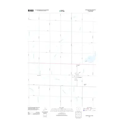
2013 Map of Ocheyedan
USGS Topo · Published 2013About this map
The town of Ocheyedan sits within a landscape defined by glacial features and agricultural grids in northwest Iowa. To the southeast, the Ocheyedan Mound rises as a prominent landmark, long recognized as one of the highest natural points in the state. This 2013 survey illustrates the local drainage patterns where the Ocheyedan River and Little Ocheyedan River meander through Osceola County, feeding toward Rush Lake and its associated Rush Lake Outlet. Local conservation is represented by Wolters Prairie, preserving a remnant of the region's original tallgrass landscape.
Find a feature on this map
38 named features on this map. Tap any name to fly to it.
Don’t see what you’re looking for? This feature index may not catch every label — zoom into the map to look around manually.
Map Details
Editions of this 2013 Ocheyedan Map
This is the sole edition of this map. No revisions or reprints were ever made.
Other maps of this area

1954 · Fairmont
USGS Topo · 1:250,000

1958 · Fairmont
USGS Topo · 1:250,000

1960 · Bigelow
USGS Topo · 1:24,000

1960 · Worthington South
USGS Topo · 1:24,000

1960 · Round Lake
USGS Topo · 1:24,000

1970 · May City
USGS Topo · 1:24,000

1970 · Harris
USGS Topo · 1:24,000

1972 · Ocheyedan
USGS Topo · 1:24,000

1972 · Cloverdale
USGS Topo · 1:24,000
1972 · Sibley East
USGS Topo · 1:24,000