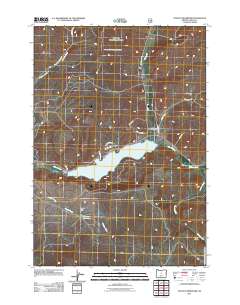
2011 Map of Ochoco Reservoir
USGS Topo · Published 2011About this map
Ochoco Reservoir dominates the center of this 2011 Crook County landscape, serving as a focal point for the region's hydraulic and agricultural infrastructure. Controlled by the Ochoco Dam, the waters of Ochoco Creek are managed alongside smaller catchments like the Yancey Reservoir to the south. The terrain varies from the flat expanse of Combs Flat to the etched drainage of Gravy Gulch, reflecting a high-desert environment where water management is paramount.
Find a feature on this map
20 named features on this map. Tap any name to fly to it.
Don’t see what you’re looking for? This feature index may not catch every label — zoom into the map to look around manually.
Map Details
Editions of this 2011 Ochoco Reservoir Map
This is the sole edition of this map. No revisions or reprints were ever made.
Other maps of this area

1946 · Eagle Rock
USGS Topo · 1:62,500

1948 · Eagle Rock
USGS Topo · 1:62,500

1948 · Ochoco Reservoir
USGS Topo · 1:62,500

1950 · Ochoco Reservoir
USGS Topo · 1:62,500

1955 · Bend
USGS Topo · 1:250,000

1957 · Bend
USGS Topo · 1:250,000

1958 · Bend
USGS Topo · 1:250,000

1962 · Prineville
USGS Topo · 1:24,000

1962 · Powell Buttes
USGS Topo · 1:62,500

1962 · Prineville
USGS Topo · 1:62,500