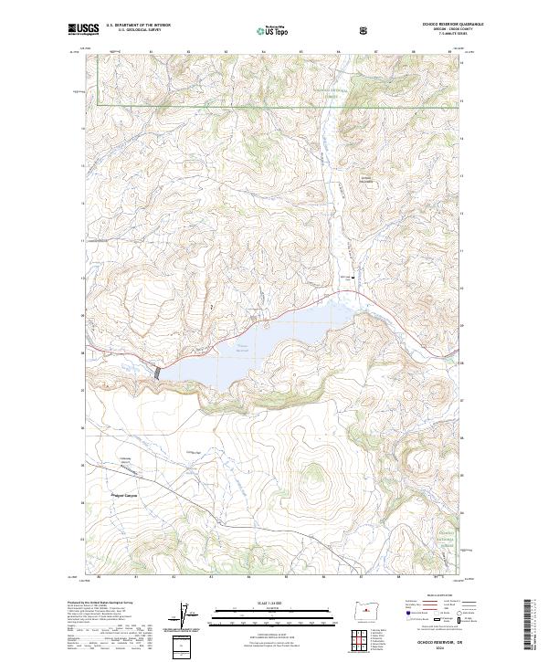
2024 Map of Ochoco Reservoir
USGS Topo · Published 2024About this map
Ochoco Reservoir dominates the center of this landscape, fed by the waters of Ochoco Creek and Polly Creek as they descend from the Ochoco Mountains. The surrounding terrain reflects a mix of public lands and scattered rural development, with the Ochoco National Forest covering the northern and southeastern elevations. Local transit and aviation are represented by the presence of the Hideaway Airport near Juniper Canyon, while the Ochoco Reservoir Public Fishing Area highlights the importance of the reservoir for local recreation. For those researching local family history, the Mill Creek Cem sits tucked away near the junction of Lawson Rd and NE Mill Creek Rd. The map also captures smaller hydrological features like the Vancey Reservoir and the broad expanse of Combs Flat to the south.
Find a feature on this map
28 named features on this map. Tap any name to fly to it.
Don’t see what you’re looking for? This feature index may not catch every label — zoom into the map to look around manually.
Map Details
Editions of this 2024 Ochoco Reservoir Map
This is the sole edition of this map. No revisions or reprints were ever made.
Other maps of this area

1946 · Eagle Rock
USGS Topo · 1:62,500

1948 · Eagle Rock
USGS Topo · 1:62,500

1948 · Ochoco Reservoir
USGS Topo · 1:62,500

1950 · Ochoco Reservoir
USGS Topo · 1:62,500

1955 · Bend
USGS Topo · 1:250,000

1957 · Bend
USGS Topo · 1:250,000

1958 · Bend
USGS Topo · 1:250,000

1962 · Prineville
USGS Topo · 1:24,000

1962 · Powell Buttes
USGS Topo · 1:62,500

1962 · Prineville
USGS Topo · 1:62,500