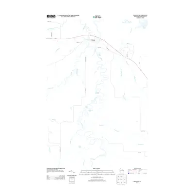
2013 Map of Odanah
USGS Topo · Published 2013About this map
The settlement of Odanah serves as the focal point of this northern Wisconsin landscape, situated at a bend in the Bad River near its confluence with the White River and Kakagon River. This aquatic network defines the region's geography, characterized by meandering watercourses that feed into the Bad River Slough toward Lake Superior. The terrain is marked by numerous small water bodies including Pictured Rock Lake, Sugarbush Lake, and Lost Lake, alongside several ponds such as Wolfs Pond and Alex Pond. Human infrastructure is concentrated along Us-2, which transects the northern portion of the map, and a network of arterial routes like Government Rd and Odanah Rd. The convergence of these significant river systems suggests a landscape deeply tied to the hydrological cycles and wetland ecosystems of Ashland County.
Find a feature on this map
33 named features on this map. Tap any name to fly to it.
Don’t see what you’re looking for? This feature index may not catch every label — zoom into the map to look around manually.
Map Details
Editions of this 2013 Odanah Map
This is the sole edition of this map. No revisions or reprints were ever made.
Other maps of this area

1942 · Ashland
USGS Topo · 1:48,000

1942 · Mellen
USGS Topo · 1:48,000

1942 · Marengo
USGS Topo · 1:48,000

1943 · Odanah
USGS Topo · 1:48,000

1945 · Odanah
USGS Topo · 1:48,000

1945 · Marengo
USGS Topo · 1:48,000

1945 · Mellen
USGS Topo · 1:48,000

1947 · Ashland
USGS Topo · 1:48,000

1953 · Ashland
USGS Topo · 1:250,000

1958 · Ashland
USGS Topo · 1:250,000