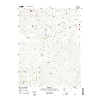
2014 Map of Odd
USGS Topo · Published 2014About this map
Guyandotte Mountain dominates this portion of the southern West Virginia coalfields, where the borders of Raleigh, Mercer, and Wyoming counties converge. The rugged topography is defined by sharp ridges like Devils Backbone and Indian Grave Mtn, with settlements often following the narrow creek valleys. Small communities such as Odd, Egeria, and Josephine are linked by winding routes like Old Egeria Rd and Backbone Rd. Local geography is deeply tied to water sources and family names, evidenced by features such as Howard Shrewsbury Spring and the numerous hollows like Schreder Hollow and Richland Hollow. This landscape illustrates the traditional Appalachian settlement pattern where habitation and transit are strictly dictated by the steep rise of peaks like Bald Knob and Rich Knob.
Find a feature on this map
79 named features on this map. Tap any name to fly to it.
Don’t see what you’re looking for? This feature index may not catch every label — zoom into the map to look around manually.
Map Details
Editions of this 2014 Odd Map
This is the sole edition of this map. No revisions or reprints were ever made.
Other maps of this area

1887 · Pocahontas
USGS Topo · 1:125,000

1891 · Pocahontas
USGS Topo · 1:125,000

1891 · Raleigh
USGS Topo · 1:125,000

1894 · Pocahontas
USGS Topo · 1:125,000

1895 · Pocahontas
USGS Topo · 1:125,000

1897 · Raleigh
USGS Topo · 1:125,000

1902 · Raleigh
USGS Topo · 1:125,000

1909 · Pocahontas Special
USGS Topo · 1:48,000

1911 · Flattop
USGS Topo · 1:48,000

1911 · Pocahontas Special
USGS Topo · 1:62,500