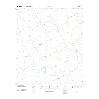
2010 Map of Odds
USGS Topo · Published 2010About this map
Erskine Cemetery and Clifton Cemetery sit among the many drainage basins of central Texas, where the terrain is defined by a dense network of tributaries including Big Elm Creek and Rocky Creek. This 2010 survey illustrates a rural landscape where small settlements like Odds and Buffalo Mop are connected by a web of local roads and farm-to-market routes. The southern portion of the map shows the headwaters of the Little Brazos River, while Steele Creek flows through the eastern reaches. The distribution of family and community landmarks, such as the Gunter Cemetery near Coit, reflects the deep-rooted agricultural history of the region. This topographical record captures the area before modern sprawling development, preserving the locations of namesake settlements like Little Elm and Big Hill that characterize the local geography.
Find a feature on this map
46 named features on this map. Tap any name to fly to it.
Don’t see what you’re looking for? This feature index may not catch every label — zoom into the map to look around manually.
Map Details
Editions of this 2010 Odds Map
This is the sole edition of this map. No revisions or reprints were ever made.
Other maps of this area

1920 · Mart
USGS Topo · 1:62,500

1954 · Waco
USGS Topo · 1:250,000

1955 · Waco
USGS Topo · 1:250,000

1956 · Mart
USGS Topo · 1:24,000

1957 · Groesbeck
USGS Topo · 1:62,500

1957 · Otto
USGS Topo · 1:24,000

1957 · McClanahan
USGS Topo · 1:24,000

1960 · Groesbeck
USGS Topo · 1:24,000

1965 · Kosse West
USGS Topo · 1:24,000

1966 · Thornton
USGS Topo · 1:24,000