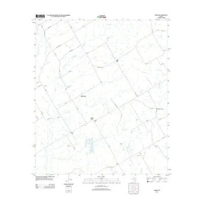
2013 Map of Odds
USGS Topo · Published 2013About this map
Big Hill rises as a prominent landmark in this rural landscape of Limestone County, where the headwaters of the Little Brazos River begin to take shape. The area is defined by a dendritic network of creeks, including Big Elm Cr, Little Elm Cr, and Steele Cr, which dictate the placement of early settlements and family cemeteries. Small rural communities like Odds, Coit, and Pleasant Grove are connected by a web of local roads such as Ranch Road 2489 and Big Hill Rd. For genealogists and local historians, the presence of Erskine Cem, Clifton Cem, and Gunter Cem provides localized data for family research in this sparsely populated agricultural region. The curious name of Buffalo Mop sits central to the quadrangle, illustrating the unique local nomenclature that persists in this part of Texas.
Find a feature on this map
59 named features on this map. Tap any name to fly to it.
Don’t see what you’re looking for? This feature index may not catch every label — zoom into the map to look around manually.
Map Details
Editions of this 2013 Odds Map
This is the sole edition of this map. No revisions or reprints were ever made.
Other maps of this area

1920 · Mart
USGS Topo · 1:62,500

1954 · Waco
USGS Topo · 1:250,000

1955 · Waco
USGS Topo · 1:250,000

1956 · Mart
USGS Topo · 1:24,000

1957 · Groesbeck
USGS Topo · 1:62,500

1957 · Otto
USGS Topo · 1:24,000

1957 · McClanahan
USGS Topo · 1:24,000

1960 · Groesbeck
USGS Topo · 1:24,000

1965 · Kosse West
USGS Topo · 1:24,000

1966 · Thornton
USGS Topo · 1:24,000