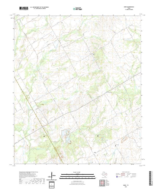
2022 Map of Odds
USGS Topo · Published 2022About this map
Big Elm Creek and its many tributaries, including Little Elm Creek and Indian Camp Creek, dominate this rural section of the central Texas prairie. This landscape is defined by the winding course of the Little Brazos River at its southern edge and the drainage systems of Rocky Creek and Steele Creek. The settlement of Coit sits near the crossing of Ranch Road 1771, serving as a focal point for the surrounding agricultural community.
Find a feature on this map
53 named features on this map. Tap any name to fly to it.
Don’t see what you’re looking for? This feature index may not catch every label — zoom into the map to look around manually.
Map Details
Editions of this 2022 Odds Map
This is the sole edition of this map. No revisions or reprints were ever made.
Other maps of this area

1920 · Mart
USGS Topo · 1:62,500

1954 · Waco
USGS Topo · 1:250,000

1955 · Waco
USGS Topo · 1:250,000

1956 · Mart
USGS Topo · 1:24,000

1957 · Groesbeck
USGS Topo · 1:62,500

1957 · Otto
USGS Topo · 1:24,000

1957 · McClanahan
USGS Topo · 1:24,000

1960 · Groesbeck
USGS Topo · 1:24,000

1965 · Kosse West
USGS Topo · 1:24,000

1966 · Thornton
USGS Topo · 1:24,000