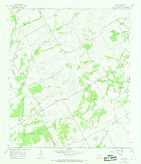
1966 Map of Odds
USGS Topo · Published 1969About this map
The rural landscape of the Limestone Co Falls Co border in the mid-1960s is defined by a dense network of winding creeks and small farming settlements. Centered on the community of Odds, the area transitions from the drainage of Big Elm Creek in the north toward the Little Brazos River in the southeast. This map reveals a high density of rural genealogy markers, including several family or community burial grounds like Erskine Cem, Clifton Cem, and Gunter Cem, alongside local spiritual centers such as Locust Grove Ch and Fairview Ch. Evidence of local industry appears in the form of several scattered Quarry sites and Oil Wells near the river, while the oddly named Buffalo Mop and the small cluster at Big Hill provide specific anchors for local historians tracking vanished or evolved Texas hamlets.
Find a feature on this map
25 named features on this map. Tap any name to fly to it.
Don’t see what you’re looking for? This feature index may not catch every label — zoom into the map to look around manually.
Map Details
Editions of this 1966 Odds Map
This is the sole edition of this map. No revisions or reprints were ever made.
Other maps of this area

1920 · Mart
USGS Topo · 1:62,500

1954 · Waco
USGS Topo · 1:250,000

1955 · Waco
USGS Topo · 1:250,000

1956 · Mart
USGS Topo · 1:24,000

1957 · Groesbeck
USGS Topo · 1:62,500

1957 · Otto
USGS Topo · 1:24,000

1957 · McClanahan
USGS Topo · 1:24,000

1960 · Groesbeck
USGS Topo · 1:24,000

1965 · Kosse West
USGS Topo · 1:24,000

1966 · Thornton
USGS Topo · 1:24,000