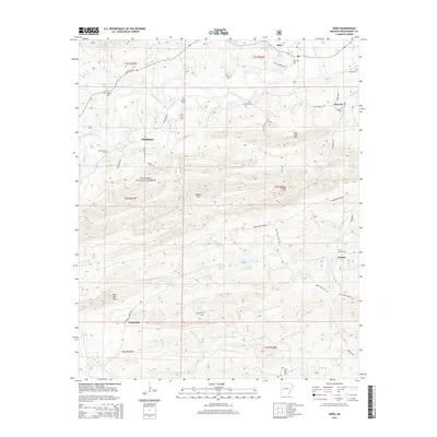
2014 Map of Oden
USGS Topo · Published 2014About this map
Oden sits along the northern edge of this terrain, where the Ouachita River winds through the valley floor before the landscape rises into the ridges of the Ouachita National Forest. The map reveals a settlement pattern deeply tied to the narrow corridors of arable land between steep peaks like Hog Jaw Mtn and Gaston Mtn. Family history is well-documented through a high density of rural burial grounds, including Oden Cem, Goodner Cem, Shirley Cem, and Mt Olive Cem, many associated with small communities like Huddleston and Gaston. Transport in the area is defined by winding forest routes such as Northfork Lake Rd and State Hwy 88, which navigate the complex drainage systems of Shirley Cr and the S Fork Ouachita River. A Lookout Tower positioned on a high ridge remains a critical landmark for managing this heavily timbered Arkansas wilderness.
Find a feature on this map
44 named features on this map. Tap any name to fly to it.
Don’t see what you’re looking for? This feature index may not catch every label — zoom into the map to look around manually.
Map Details
Editions of this 2014 Oden Map
This is the sole edition of this map. No revisions or reprints were ever made.
Other maps of this area

1890 · Mount Ida
USGS Topo · 1:125,000

1906 · Caddo Gap
USGS Topo · 1:125,000

1936 · Athens
USGS Topo · 1:48,000

1936 · Glenwood
USGS Topo · 1:48,000

1942 · Glenwood
USGS Topo · 1:62,500

1942 · Athens
USGS Topo · 1:62,500

1949 · Glenwood
USGS Topo · 1:62,500

1955 · Little Rock
USGS Topo · 1:250,000

1956 · Little Rock
USGS Topo · 1:250,000

1959 · Oden
USGS Topo · 1:62,500