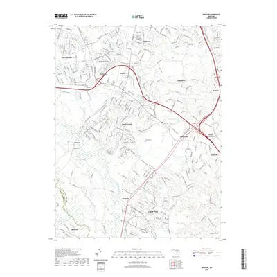
2019 Map of Odenton
USGS Topo · Published 2019About this map
Fort Meade and the surrounding suburban corridors of Odenton and Crofton define this central Maryland landscape. The survey documents an area heavily shaped by military installations and transportation networks, with Meadedale and Mayfield providing residential buffer zones near the base. A remarkable density of family and institutional burial grounds is preserved across the terrain, including Our Lady of the Field Cem, Macedonia Cem, and the Woodward Cem. These sites, along with the Disney Cem and Sulpher Springs Cem, offer vital touchpoints for genealogists tracing the pre-suburban heritage of the region. The natural drainage of the Little Patuxent River and Severn Run creates a winding contrast to the rigid geometry of the modern road system, while smaller landmarks like Walking Fish Pond and Soldier Lake highlight the localized hydrology of the Anne Arundel County interior.
Find a feature on this map
273 named features on this map. Tap any name to fly to it.
Don’t see what you’re looking for? This feature index may not catch every label — zoom into the map to look around manually.
Map Details
Editions of this 2019 Odenton Map
This is the sole edition of this map. No revisions or reprints were ever made.
Other maps of this area

1892 · Laurel
USGS Topo · 1:62,500

1892 · Owensville
USGS Topo · 1:62,500

1894 · Laurel
USGS Topo · 1:62,500

1894 · Relay
USGS Topo · 1:62,500

1895 · Owensville
USGS Topo · 1:62,500

1897 · Laurel
USGS Topo · 1:62,500

1899 · Patuxent
USGS Topo · 1:125,000

1900 · Washington
USGS Topo · 1:62,500

1905 · Owensville
USGS Topo · 1:62,500

1906 · Patuxent
USGS Topo · 1:125,000