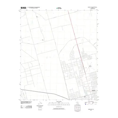
2010 Map of Odessa NW
USGS Topo · Published 2010About this map
Odessa expands northward in this 2010 survey, showcasing the transition from a structured urban grid to the open ranch land of Ector County. The residential and commercial density of the city gives way to the expansive northern outskirts where traditional livestock and water infrastructure remain prominent, marked by labels like West Windmill and South Windmill. This period captures the city's peripheral growth as the bypass system of NW Loop 338 and NE Loop 338 circles the metropolitan area, bridging the gap between urban development and rural range roads like Y T Ranch Rd.
Find a feature on this map
21 named features on this map. Tap any name to fly to it.
Don’t see what you’re looking for? This feature index may not catch every label — zoom into the map to look around manually.
Map Details
Editions of this 2010 Odessa NW Map
This is the sole edition of this map. No revisions or reprints were ever made.
Other maps of this area

1954 · Hobbs
USGS Topo · 1:250,000

1954 · Pecos
USGS Topo · 1:250,000

1957 · Pecos
USGS Topo · 1:250,000

1958 · Hobbs
USGS Topo · 1:250,000

1964 · Odessa NE
USGS Topo · 1:24,000

1964 · Odessa SW
USGS Topo · 1:24,000

1964 · Odessa NW
USGS Topo · 1:24,000

1964 · Odessa SE
USGS Topo · 1:24,000

1964 · Douro
USGS Topo · 1:24,000

1965 · Goldsmith
USGS Topo · 1:24,000