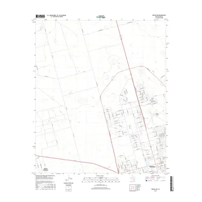
2016 Map of Odessa NW
USGS Topo · Published 2016About this map
Odessa expansion and the rural infrastructure of the Permian Basin are documented in this 2016 survey. The map details the transition from the dense street grids of West Odessa and the city's northwestern neighborhoods to the open ranch land and utility corridors of Ector County. Aviation and industrial commerce are centered at Odessa-Schlemeyer Field, while the periphery is defined by a network of specialized routes such as Wire Line Rd, Altura Lease Rd, and Y T Ranch Rd. These labels reflect the region's historical and ongoing reliance on the petroleum industry and ranching. The layout of recent residential developments, including named thoroughfares like Cabrillo Dr and Rainbow Dr, provides a clear record of 21st-century suburban growth alongside older features like NW Lake and the significant transit corridor of NW Loop 338.
Find a feature on this map
136 named features on this map. Tap any name to fly to it.
Don’t see what you’re looking for? This feature index may not catch every label — zoom into the map to look around manually.
Map Details
Editions of this 2016 Odessa NW Map
This is the sole edition of this map. No revisions or reprints were ever made.
Other maps of this area

1954 · Hobbs
USGS Topo · 1:250,000

1954 · Pecos
USGS Topo · 1:250,000

1957 · Pecos
USGS Topo · 1:250,000

1958 · Hobbs
USGS Topo · 1:250,000

1964 · Odessa NE
USGS Topo · 1:24,000

1964 · Odessa SW
USGS Topo · 1:24,000

1964 · Odessa NW
USGS Topo · 1:24,000

1964 · Odessa SE
USGS Topo · 1:24,000

1964 · Douro
USGS Topo · 1:24,000

1965 · Goldsmith
USGS Topo · 1:24,000