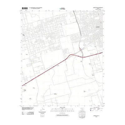
2010 Map of Odessa SW
USGS Topo · Published 2010About this map
Foster Oil Field and the expansive Cowden Oil Field define the industrial character of this West Texas landscape southwest of Odessa. The transition from the dense street grids of West Odessa to the open, infrastructure-heavy rangeland of the Permian Basin is clearly visible. The area is dotted with family and place-named landmarks that hint at the region's agricultural and energy history, including the Henderson Jog Windmill, Crater Windmill, and North Windmill. Transport corridors like W Murphy St and SW Loop 338 cut through the terrain, connecting smaller settlements like Arcade and Sid Richardson to the larger urban center. The intermittent path of Monahans Draw provides a natural break in the predominantly human-altered landscape of pumps, tanks, and service roads.
Find a feature on this map
32 named features on this map. Tap any name to fly to it.
Don’t see what you’re looking for? This feature index may not catch every label — zoom into the map to look around manually.
Map Details
Editions of this 2010 Odessa SW Map
This is the sole edition of this map. No revisions or reprints were ever made.
Other maps of this area

1954 · Pecos
USGS Topo · 1:250,000

1957 · Pecos
USGS Topo · 1:250,000

1964 · Odessa NE
USGS Topo · 1:24,000

1964 · Odessa SW
USGS Topo · 1:24,000

1964 · Odessa NW
USGS Topo · 1:24,000

1964 · Odessa SE
USGS Topo · 1:24,000

1964 · Douro
USGS Topo · 1:24,000

1964 · Penwell
USGS Topo · 1:24,000

1964 · Clark Brothers Ranch
USGS Topo · 1:24,000

1965 · South Cowden Ranch
USGS Topo · 1:24,000