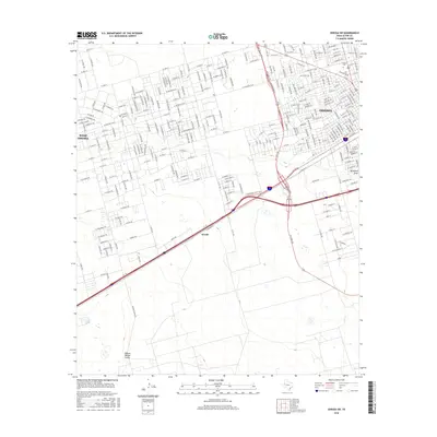
2016 Map of Odessa SW
USGS Topo · Published 2016About this map
The Odessa Meteor Crater anchors the southwestern reaches of this Ector County landscape, a significant geological landmark situated just south of the developing outskirts of West Odessa. This 2016 survey illustrates the extensive grid of residential and commercial expansion west of Odessa, where long-established routes like W University Blvd connect various neighborhoods to the urban core. Further south, the landscape transitions toward the small settlement of Arcade and the area near Berry, illustrating the shift from dense suburban blocks to more open West Texas terrain. The passage of Monahans Draw through the southeastern corner provides a glimpse into the natural drainage patterns of this arid region, while street names like W Tomahawk Trl and W Tee Pee Trl reflect the local residential character and naming conventions of the era.
Find a feature on this map
86 named features on this map. Tap any name to fly to it.
Don’t see what you’re looking for? This feature index may not catch every label — zoom into the map to look around manually.
Map Details
Editions of this 2016 Odessa SW Map
This is the sole edition of this map. No revisions or reprints were ever made.
Other maps of this area

1954 · Pecos
USGS Topo · 1:250,000

1957 · Pecos
USGS Topo · 1:250,000

1964 · Odessa NE
USGS Topo · 1:24,000

1964 · Odessa SW
USGS Topo · 1:24,000

1964 · Odessa NW
USGS Topo · 1:24,000

1964 · Odessa SE
USGS Topo · 1:24,000

1964 · Douro
USGS Topo · 1:24,000

1964 · Penwell
USGS Topo · 1:24,000

1964 · Clark Brothers Ranch
USGS Topo · 1:24,000

1965 · South Cowden Ranch
USGS Topo · 1:24,000