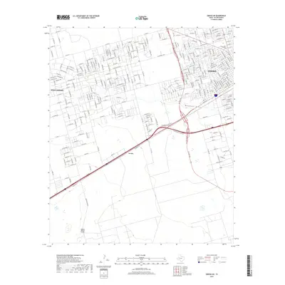
2019 Map of Odessa SW
USGS Topo · Published 2019About this map
Odessa Meteor Crater anchors the southern reaches of this landscape, marking a significant geological feature amidst the expanding urban grid of Ector County. The map captures the transition from the dense residential and commercial blocks of Odessa and West Odessa to the more open ranch and industrial lands to the south. Transportation infrastructure is central to the area's layout, dominated by the junction of W Interstate 20 State Rte and the massive loop system, including SW Loop 338 and NW Loop 338. This network facilitates movement between the central city and smaller outlying points like Arcade and Berry. The drainage of Monahans Draw cuts across the central portion of the sheet, providing a natural topographical counterpoint to the engineered precision of the surrounding street names and highway interchanges.
Find a feature on this map
251 named features on this map. Tap any name to fly to it.
Don’t see what you’re looking for? This feature index may not catch every label — zoom into the map to look around manually.
Map Details
Editions of this 2019 Odessa SW Map
This is the sole edition of this map. No revisions or reprints were ever made.
Other maps of this area

1954 · Pecos
USGS Topo · 1:250,000

1957 · Pecos
USGS Topo · 1:250,000

1964 · Odessa NE
USGS Topo · 1:24,000

1964 · Odessa SW
USGS Topo · 1:24,000

1964 · Odessa NW
USGS Topo · 1:24,000

1964 · Odessa SE
USGS Topo · 1:24,000

1964 · Douro
USGS Topo · 1:24,000

1964 · Penwell
USGS Topo · 1:24,000

1964 · Clark Brothers Ranch
USGS Topo · 1:24,000

1965 · South Cowden Ranch
USGS Topo · 1:24,000