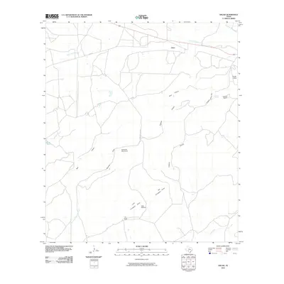
2010 Map of Odlaw
USGS Topo · Published 2010About this map
The Anacacho Mountains anchor this southern Texas landscape in Kinney County, characterized by a complex network of draws and canyons that define the local drainage patterns. Remote ranching infrastructure is evident at the Old Altizer Ranch and near the settlement of Odlaw, located along the northern edge of the survey. The topography is marked by evocative local place names such as Hells Halfacre and the Big Fryingpan Valley, which suggest the challenging environmental conditions encountered by early settlers and cattlemen in this arid region.
Find a feature on this map
24 named features on this map. Tap any name to fly to it.
Don’t see what you’re looking for? This feature index may not catch every label — zoom into the map to look around manually.
Map Details
Editions of this 2010 Odlaw Map
This is the sole edition of this map. No revisions or reprints were ever made.
Other maps of this area

1896 · Brackett
USGS Topo · 1:125,000

1897 · Brackett
USGS Topo · 1:125,000

1938 · Turkey Mountain
USGS Topo · 1:48,000

1943 · Turkey Mountain
USGS Topo · 1:62,500

1944 · Spofford
USGS Topo · 1:62,500

1944 · Brackettville
USGS Topo · 1:62,500

1949 · Cline
USGS Topo · 1:62,500

1958 · Del Rio
USGS Topo · 1:250,000

1964 · Del Rio
USGS Topo · 1:250,000
1974 · Elm Mountain
USGS Topo · 1:24,000