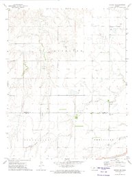
1972 Map of Offerle NW
USGS Topo · Published 1974About this map
White Woman Creek and Little Coon Creek meander across this High Plains landscape, which straddles the boundary between Hodgeman and Ford counties. In the early 1970s, the region was defined by a mix of agricultural township divisions, including Sterling, Spearville, and Wheatland, alongside emerging energy and mineral extraction. Evidence of local industry is visible through several Gravel Pits and scattered Oil Wells in the northeastern quadrant.
Find a feature on this map
14 named features on this map. Tap any name to fly to it.
Don’t see what you’re looking for? This feature index may not catch every label — zoom into the map to look around manually.
Map Details
Editions of this 1972 Offerle NW Map
This is the sole edition of this map. No revisions or reprints were ever made.
Other maps of this area

1892 · Ness
USGS Topo · 1:125,000

1892 · Spearville
USGS Topo · 1:125,000

1894 · Spearville
USGS Topo · 1:125,000

1894 · Ness
USGS Topo · 1:125,000

1955 · Great Bend
USGS Topo · 1:250,000

1955 · Pratt
USGS Topo · 1:250,000

1957 · Great Bend
USGS Topo · 1:250,000

1958 · Great Bend
USGS Topo · 1:250,000

1959 · Pratt
USGS Topo · 1:250,000

1970 · Jetmore SE
USGS Topo · 1:24,000