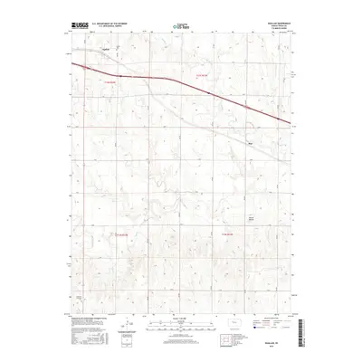
2015 Map of Ogallah
USGS Topo · Published 2015About this map
Ogallah is situated in the high plains of Trego County, where the landscape is defined by the steady drainages of Spring Cr and Big Cr. This 2015 survey illustrates a rural environment shaped by a methodical grid of gravel roads including K RD and R RD, which partition the agricultural sections. The map reveals the community's roots through sites like Oglala Cem near the town center and the Emanuel Lutheran Cem to the south. A prominent natural landmark, Round Mound, rises above the surrounding fields, providing a rare topographic break in the western Kansas horizon. The infrastructure reflects a classic prairie transit corridor, with the settlement of Riga positioned southeast of the main township, while large tracts of land remain dedicated to cultivation and ranching under the Public Land Survey System divisions.
Find a feature on this map
26 named features on this map. Tap any name to fly to it.
Don’t see what you’re looking for? This feature index may not catch every label — zoom into the map to look around manually.
Map Details
Editions of this 2015 Ogallah Map
This is the sole edition of this map. No revisions or reprints were ever made.
Other maps of this area

1893 · Ellis
USGS Topo · 1:125,000

1893 · Hill
USGS Topo · 1:125,000

1955 · Great Bend
USGS Topo · 1:250,000

1955 · Beloit
USGS Topo · 1:250,000

1957 · Great Bend
USGS Topo · 1:250,000

1958 · Great Bend
USGS Topo · 1:250,000

1959 · Beloit
USGS Topo · 1:250,000
1960 · Trego Center NE
USGS Topo · 1:24,000
1961 · Ogallah
USGS Topo · 1:24,000
1961 · Ellis
USGS Topo · 1:24,000