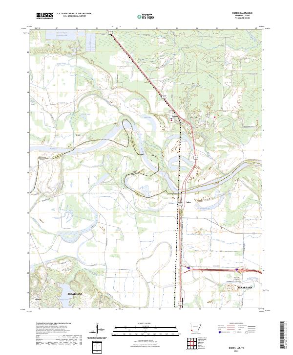
2024 Map of Ogden
USGS Topo · Published 2024About this map
The Red River defines the complex jurisdictional landscape of the borderlands between Arkansas and Texas, winding through a series of oxbows and cut-offs that isolate various land parcels. Near the northern bend, the settlement of Ogden serves as a local hub, while the industrial imprint of the Nacoosa Paper Retention Pond sits further west. The topography is dominated by hydrological features, ranging from the broad McKinney Bayou to various floodplain lakes like Winham Lake and Mill Lake.
Find a feature on this map
65 named features on this map. Tap any name to fly to it.
Don’t see what you’re looking for? This feature index may not catch every label — zoom into the map to look around manually.
Map Details
Editions of this 2024 Ogden Map
This is the sole edition of this map. No revisions or reprints were ever made.
Other maps of this area

1909 · Texarkana
USGS Topo · 1:62,500

1950 · Ashdown East
USGS Topo · 1:24,000

1950 · Ashdown West
USGS Topo · 1:24,000

1950 · Ogden
USGS Topo · 1:24,000

1950 · Red Bluff
USGS Topo · 1:24,000

1950 · Barkman
USGS Topo · 1:24,000

1951 · Ashdown West
USGS Topo · 1:24,000

1951 · Ogden
USGS Topo · 1:24,000

1951 · Red Bluff
USGS Topo · 1:24,000

1951 · Ashdown East
USGS Topo · 1:24,000