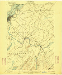
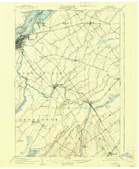
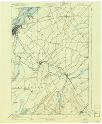
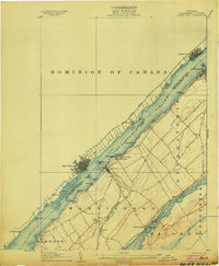
1905 Map of Ogdensburg
USGS Topo · Published 1916About this map
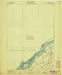
The St Lawrence River serves as the international boundary between the United States and the Dominion of Canada at the turn of the century, with Ogdensburg acting as a bustling rail and river hub. A complex network of transit lines, including the Rutland RR and the New York Central and Hudson River RR, converges here, illustrating the era's heavy reliance on rail for commerce across St. Lawrence County. To the east of the city, the sprawling St Lawrence State Hospital occupies a prominent position on the shoreline near Chimney Point.
Find a feature on this map
53 named features on this map. Tap any name to fly to it.
Don’t see what you’re looking for? This feature index may not catch every label — zoom into the map to look around manually.
Map Details
Editions of this 1905 Ogdensburg Map
4 editions found
Other maps of this area

1904 · Lisbon
USGS Topo · 1:48,000

1904 · Ogdensburg
USGS Topo · 1:62,500

1905 · Waddington
USGS Topo · 1:62,500

1905 · Ogdensburg
USGS Topo · 1:62,500
1906 · Brier Hill
USGS Topo · 1:62,500
1906 · Red Mills
USGS Topo · 1:62,500

1910 · Canton
USGS Topo · 1:62,500

1911 · Canton
USGS Topo · 1:62,500

1912 · Hammond
USGS Topo · 1:62,500

1915 · Gouverneur
USGS Topo · 1:62,500