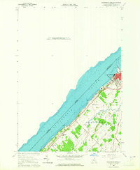
1963 Map of Ogdensburg West
USGS Topo · Published 1965About this map
The St Lawrence River defines the international boundary and the economic life of this border region in the early 1960s. Along the southern shore, the Ogdensburg corporate limits encompass a dense network of institutional and industrial infrastructure, including a prominent Lighthouse, a Waterworks, and a Ferry crossing to Ontario. The influence of the New York Central Railroad is evident as it parallels the riverbank, connecting the town’s core to rural landscapes marked by educational institutions like Wadhams Hall Seminary and Mater Dei College.
Find a feature on this map
28 named features on this map. Tap any name to fly to it.
Don’t see what you’re looking for? This feature index may not catch every label — zoom into the map to look around manually.
Map Details
Editions of this 1963 Ogdensburg West Map
2 editions found
Other maps of this area

1904 · Lisbon
USGS Topo · 1:48,000

1904 · Ogdensburg
USGS Topo · 1:62,500

1905 · Ogdensburg
USGS Topo · 1:62,500

1906 · Brier Hill
USGS Topo · 1:62,500

1906 · Red Mills
USGS Topo · 1:62,500

1942 · Morristown
USGS Topo · 1:24,000

1943 · Ogdensburg East
USGS Topo · 1:31,680

1943 · Morristown
USGS Topo · 1:31,680
1943 · Red Mills
USGS Topo · 1:31,680

1943 · Edwardsville
USGS Topo · 1:31,680