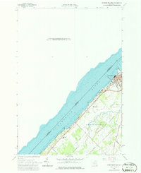
1963 Map of Ogdensburg West
USGS Topo · Published 1979About this map
Ogdensburg stands at the strategic meeting point of the St Lawrence River and the Oswegatchie River, serving as a vital international gateway along the border with Canada in the early 1960s. The landscape is defined by its deep-water access and institutional infrastructure, featuring the Wadhams Hall Seminary and Mater Dei College, alongside specialized facilities like the Home for the Aged. Industrial and maritime activity is concentrated along the riverfront, where a Lighthouse and a Ferry crossing to Ontario signify the city's role as a port of entry. Local transportation and industry are supported by the New York Central Railroad which skirts the riverbank, and extensive extractive sites including Quarries located on the city's edge. Beyond the urban core, rural family names are preserved on routes such as Lovejoy Road and Hutchinson Road, while the mid-century culture of the era is represented by a Drive-in Theater near Nevins Pt.
Find a feature on this map
28 named features on this map. Tap any name to fly to it.
Don’t see what you’re looking for? This feature index may not catch every label — zoom into the map to look around manually.
Map Details
Editions of this 1963 Ogdensburg West Map
2 editions found
Other maps of this area

1904 · Lisbon
USGS Topo · 1:48,000

1904 · Ogdensburg
USGS Topo · 1:62,500

1905 · Ogdensburg
USGS Topo · 1:62,500

1906 · Brier Hill
USGS Topo · 1:62,500

1906 · Red Mills
USGS Topo · 1:62,500

1942 · Morristown
USGS Topo · 1:24,000

1943 · Ogdensburg East
USGS Topo · 1:31,680

1943 · Morristown
USGS Topo · 1:31,680
1943 · Red Mills
USGS Topo · 1:31,680

1943 · Edwardsville
USGS Topo · 1:31,680