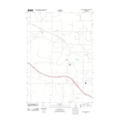
2011 Map of Ogemaw Springs
USGS Topo · Published 2011About this map
Ogemaw Springs serves as the focal point of this northern Michigan landscape, where the headwaters of Ogemaw Creek and Smith Creek begin their winding descent. The area is defined by a network of rural trails and roads, including the historic Meridian Rd and the sweeping curve of W M 76. High ground such as Preachers Hill and Pointers Hill provides a contrast to the low-lying wetlands and numerous kettle lakes like Beaver Lake and Ogemaw Lake. For those tracing local roots, the map provides precise locations for both the Ogemaw Springs Cemetery and the Beaver Lake Cemetery. This survey illustrates a quiet transition between managed forests and small-scale settlements, connected by a dense web of established paths like St Helen Trl and Beaver Lake Trl.
Find a feature on this map
49 named features on this map. Tap any name to fly to it.
Don’t see what you’re looking for? This feature index may not catch every label — zoom into the map to look around manually.
Map Details
Editions of this 2011 Ogemaw Springs Map
This is the sole edition of this map. No revisions or reprints were ever made.
Other maps of this area

1954 · Traverse City
USGS Topo · 1:250,000

1958 · Traverse City
USGS Topo · 1:250,000

1965 · Damon
USGS Topo · 1:24,000

1965 · St. Helen NW
USGS Topo · 1:24,000

1965 · St. Helen NE
USGS Topo · 1:24,000

1965 · West Branch
USGS Topo · 1:24,000

1965 · St. Helen
USGS Topo · 1:24,000

1965 · Ogemaw Springs
USGS Topo · 1:24,000

1968 · Sterling NW
USGS Topo · 1:24,000

1969 · Edwards
USGS Topo · 1:24,000