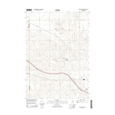
2014 Map of Ogemaw Springs
USGS Topo · Published 2014About this map
Ogemaw Springs serves as a historical focal point in this portion of Ogemaw County, situated north of the growing city of West Branch. The landscape is characterized by a series of glacial lakes, including Beaver Lake, Ogemaw Lake, and Heintz Lake, which are interconnected by drainages such as Ogemaw Cr and Smith Cr. The presence of Ogemaw Springs Cem and Beaver Lake Cem indicates long-standing local communities rooted in the area's geography. High points like Preachers Hill and Pointers Hill provide topographic variety, while a dense network of local routes like Sage Rd and Beaver Lake Trl connect the residential developments around the various lakes. The map illustrates the contemporary expansion of West Branch as it extends northwest toward the historic spring area.
Find a feature on this map
67 named features on this map. Tap any name to fly to it.
Don’t see what you’re looking for? This feature index may not catch every label — zoom into the map to look around manually.
Map Details
Editions of this 2014 Ogemaw Springs Map
This is the sole edition of this map. No revisions or reprints were ever made.
Other maps of this area

1954 · Traverse City
USGS Topo · 1:250,000

1958 · Traverse City
USGS Topo · 1:250,000

1965 · Damon
USGS Topo · 1:24,000

1965 · St. Helen NW
USGS Topo · 1:24,000

1965 · St. Helen NE
USGS Topo · 1:24,000

1965 · West Branch
USGS Topo · 1:24,000

1965 · St. Helen
USGS Topo · 1:24,000

1965 · Ogemaw Springs
USGS Topo · 1:24,000

1968 · Sterling NW
USGS Topo · 1:24,000

1969 · Edwards
USGS Topo · 1:24,000