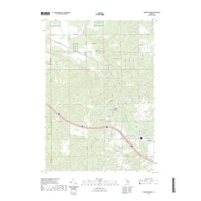
2023 Map of Ogemaw Springs
USGS Topo · Published 2023About this map
The Kirtlands Warbler Wildlife Management Area anchors the northern portion of this Ogemaw County landscape, highlighting a region dedicated to specialized habitat conservation. Settlement patterns are concentrated around the historic community of Ogemaw Springs and the northwestern edge of West Branch, where the terrain transitions from protected wildlife zones to developed infrastructure. The map reveals a complex network of glacial hydrology, including the Ogemaw Swamp, Harcourt Swamp, and several small lakes such as Beaver Lake and Heintz Lake. High points like Preachers Hill and Pointers Hill rise above the wetlands and creek beds, providing local relief. For genealogists and local historians, the inclusion of Beaver Lake Cem and Ogemaw Springs Cem provides critical points for family research within this rural Michigan corridor.
Find a feature on this map
56 named features on this map. Tap any name to fly to it.
Don’t see what you’re looking for? This feature index may not catch every label — zoom into the map to look around manually.
Map Details
Editions of this 2023 Ogemaw Springs Map
This is the sole edition of this map. No revisions or reprints were ever made.
Other maps of this area

1954 · Traverse City
USGS Topo · 1:250,000

1958 · Traverse City
USGS Topo · 1:250,000

1965 · Damon
USGS Topo · 1:24,000

1965 · St. Helen NW
USGS Topo · 1:24,000

1965 · St. Helen NE
USGS Topo · 1:24,000

1965 · West Branch
USGS Topo · 1:24,000

1965 · St. Helen
USGS Topo · 1:24,000

1965 · Ogemaw Springs
USGS Topo · 1:24,000

1968 · Sterling NW
USGS Topo · 1:24,000

1969 · Edwards
USGS Topo · 1:24,000