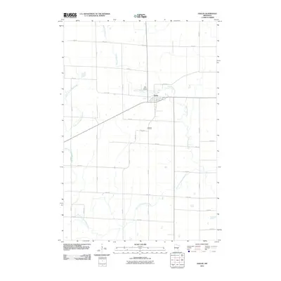
2010 Map of Ogilvie
USGS Topo · Published 2010About this map
Ogilvie serves as the central hub of this Kanabec County landscape, where the confluence of local transit and river geography shaped the community. The town is situated just south of the Groundhouse River and is reached by a grid of rural roads including S Hill Ave and 170th Ave. To the west and south, the South Fork Groundhouse River meanders through the terrain, defining the natural drainage patterns of the area. Genealogists will find interest in the local burial grounds, specifically Saint Kathryn Cemetery located north of the town center and Graceland Cemetery to the south. The surrounding landscape is marked by a precise network of named corridors such as Eagle St, Delta St, and Cable St, reflecting the systematic development of the region's agricultural and residential plots by the early twenty-first century.
Find a feature on this map
28 named features on this map. Tap any name to fly to it.
Don’t see what you’re looking for? This feature index may not catch every label — zoom into the map to look around manually.
Map Details
Editions of this 2010 Ogilvie Map
This is the sole edition of this map. No revisions or reprints were ever made.
Other maps of this area

1953 · Stillwater
USGS Topo · 1:250,000

1955 · Stillwater
USGS Topo · 1:250,000

1958 · Stillwater
USGS Topo · 1:250,000

1961 · Springvale
USGS Topo · 1:24,000

1961 · Dalbo
USGS Topo · 1:24,000

1961 · Dalbo
USGS Topo · 1:62,500

1965 · Stillwater
USGS Topo · 1:250,000

1968 · Milaca NE
USGS Topo · 1:24,000

1968 · Ann Lake
USGS Topo · 1:24,000

1968 · Mora North
USGS Topo · 1:24,000