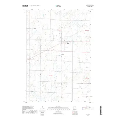
2019 Map of Ogilvie
USGS Topo · Published 2019About this map
Ogilvie serves as the central hub of this Kanabec County landscape, where the local road network converges near the banks of the Groundhouse River. The town's grid, featuring streets like Hill Ave and E Anderson St, is surrounded by a patchwork of wetlands and agricultural tracts. This 2019 survey documents the enduring layout of rural intersections and family sites, including Saint Kathryn Cem and Graceland Cem located just south of the main settlement. The hydrology is dominated by the meandering paths of the river and its S Fork Groundhouse River, which cut through the township lines of T39N and T38N. A dense system of section-line roads, such as Co Rd 57 and Co Rd 60, provides precise spatial context for property researchers and local historians tracking the development of this Minnesota region.
Find a feature on this map
41 named features on this map. Tap any name to fly to it.
Don’t see what you’re looking for? This feature index may not catch every label — zoom into the map to look around manually.
Map Details
Editions of this 2019 Ogilvie Map
This is the sole edition of this map. No revisions or reprints were ever made.
Other maps of this area

1953 · Stillwater
USGS Topo · 1:250,000

1955 · Stillwater
USGS Topo · 1:250,000

1958 · Stillwater
USGS Topo · 1:250,000

1961 · Springvale
USGS Topo · 1:24,000

1961 · Dalbo
USGS Topo · 1:24,000

1961 · Dalbo
USGS Topo · 1:62,500

1965 · Stillwater
USGS Topo · 1:250,000

1968 · Milaca NE
USGS Topo · 1:24,000

1968 · Ann Lake
USGS Topo · 1:24,000

1968 · Mora North
USGS Topo · 1:24,000