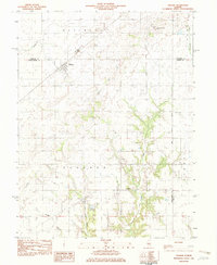
1982 Map of Ohlman
USGS Topo · Published 1982About this map
Ohlman stands as the primary settlement in this corner of Central Illinois, situated at the junction of Montgomery and Christian Counties. The landscape is defined by its agricultural grid, centered around the Missouri Pacific Conrail line that cuts diagonally through the northern territory. Local history is anchored by rural landmarks such as Shiloh Ch and Rosamond Grove Cem, which serve the surrounding townships of Rosamond and Audubon. The terrain transitions from flat prairie in the north to a more dissected drainage system in the south, where Ramsey Creek and Elliott Creek carve into the upland. Notable surveying history is present in the form of the Third Principal Meridian, which forms the eastern boundary of the map, marking a fundamental line in the settlement and division of Illinois lands.
Find a feature on this map
18 named features on this map. Tap any name to fly to it.
Don’t see what you’re looking for? This feature index may not catch every label — zoom into the map to look around manually.
Map Details
Editions of this 1982 Ohlman Map
This is the sole edition of this map. No revisions or reprints were ever made.
Other maps of this area

1944 · Ramsey
USGS Topo · 1:62,500

1946 · Ramsey
USGS Topo · 1:62,500

1946 · Nokomis
USGS Topo · 1:62,500

1947 · Pana
USGS Topo · 1:62,500

1947 · Hillsboro
USGS Topo · 1:62,500

1949 · Hillsboro
USGS Topo · 1:62,500

1949 · Nokomis
USGS Topo · 1:62,500

1949 · Pana
USGS Topo · 1:62,500

1958 · Decatur
USGS Topo · 1:250,000

1961 · Decatur
USGS Topo · 1:250,000