
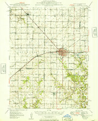
1949 Map of Pana
USGS Topo · Published 1949About this map
Pana serves as a major rail hub in this late 1940s survey, where five different lines including the Baltimore and Ohio RR and Illinois Central RR converge. This dense network of tracks highlights the town's industrial importance to the central Illinois prairie. The surrounding landscape is a detailed map of early midwestern rural life, peppered with one-room schoolhouses like Swamp Angel Sch and Durbin College Sch. Genealogists will find a high concentration of burial sites, ranging from the Potters Field near the Third Principal Meridian to Sacred Heart Cem in Oconee. Beyond the town centers of Owaneco and Rosamond, the land is drained by complex systems like the Main Drainage Ditch, supporting the agricultural character of the Christian, Shelby, and Montgomery county borders.
Find a feature on this map
87 named features on this map. Tap any name to fly to it.
Don’t see what you’re looking for? This feature index may not catch every label — zoom into the map to look around manually.
Map Details
Editions of this 1949 Pana Map
2 editions found
Other maps of this area

1923 · Taylorville
USGS Topo · 1:62,500

1925 · Taylorville
USGS Topo · 1:62,500

1941 · St. Elmo
USGS Topo · 1:62,500

1942 · Shelbyville
USGS Topo · 1:62,500

1944 · Ramsey
USGS Topo · 1:62,500

1945 · St. Elmo
USGS Topo · 1:62,500

1946 · Shelbyville
USGS Topo · 1:62,500

1946 · Ramsey
USGS Topo · 1:62,500

1946 · Nokomis
USGS Topo · 1:62,500

1947 · Pana
USGS Topo · 1:62,500