
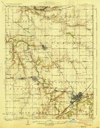
1925 Map of Taylorville
USGS Topo · Published 1925About this map
Taylorville serves as the focal point of this Central Illinois landscape, where the confluence of the Sangamon River and its South Fork dictates the layout of the land. In the early 1920s, the region was defined by a dense network of rural infrastructure, including dozens of one-room schoolhouses like Brush College and Sand Ridge School. The industrial character of the era is visible in the cluster of mining and rail settlements around Kincaid, Jeisyville, and Bulpitt, which grew alongside the Chicago and Illinois Midland RR. Further north, smaller agricultural centers such as Edinburg and Sharpsburg are connected by the Baltimore and Ohio RR. The map preserves the names of long-standing community landmarks, including Bethany Church and Good Hope Church, alongside forgotten rail stops like Humphrey Sta.
Find a feature on this map
83 named features on this map. Tap any name to fly to it.
Don’t see what you’re looking for? This feature index may not catch every label — zoom into the map to look around manually.
Map Details
Editions of this 1925 Taylorville Map
2 editions found
Other maps of this area

1907 · Springfield
USGS Topo · 1:62,500

1922 · Divernon
USGS Topo · 1:62,500

1923 · Taylorville
USGS Topo · 1:62,500

1923 · Raymond
USGS Topo · 1:62,500

1924 · Divernon
USGS Topo · 1:62,500

1925 · Raymond
USGS Topo · 1:62,500

1930 · Springfield
USGS Topo · 1:62,500

1940 · Springfield
USGS Topo · 1:62,500

1946 · Nokomis
USGS Topo · 1:62,500

1947 · Pana
USGS Topo · 1:62,500