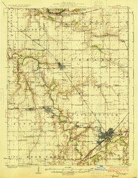
1925 Map of Taylorville
USGS Topo · Published 1925About this map
Taylorville and its surrounding central Illinois prairie land appear at a moment of transition in the mid-1920s, characterized by a dense network of rural schoolhouses and the expansion of the rail system. The South Fork Sangamon River and Bear Creek carve distinct paths through the landscape, providing natural drainage for the agricultural terrain of Christian Co. The influence of the coal and rail industries is evident in the cluster of mining and transit hubs like Kincaid, Bulpitt, and Humphrey Sta, alongside the Chicago and Illinois Midland tracks.
Find a feature on this map
81 named features on this map. Tap any name to fly to it.
Don’t see what you’re looking for? This feature index may not catch every label — zoom into the map to look around manually.
Map Details
Editions of this 1925 Taylorville Map
2 editions found
Other maps of this area

1907 · Springfield
USGS Topo · 1:62,500

1922 · Divernon
USGS Topo · 1:62,500

1923 · Taylorville
USGS Topo · 1:62,500

1923 · Raymond
USGS Topo · 1:62,500

1924 · Divernon
USGS Topo · 1:62,500

1925 · Taylorville
USGS Topo · 1:62,500

1925 · Raymond
USGS Topo · 1:62,500

1930 · Springfield
USGS Topo · 1:62,500

1940 · Springfield
USGS Topo · 1:62,500

1946 · Nokomis
USGS Topo · 1:62,500