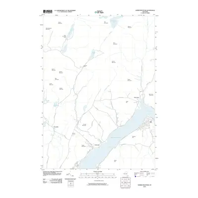
2010 Map of Ohmer Mountain
USGS Topo · Published 2010About this map
Great Sacandaga Lake dominates the southern portion of this landscape, its expansive shoreline defining the local geography of northern Saratoga County. Small lakeside settlements and landings like West Day, Lake View, and Day Center occupy the lower elevations, where N Shore Rd and S Shore Rd trace the water's edge. This modern survey illustrates the proximity of residential development to the steep, wooded slopes of the Adirondack foothills, with Youngs Mountain and Fraker Mountain rising sharply from the lake's banks.
Find a feature on this map
57 named features on this map. Tap any name to fly to it.
Don’t see what you’re looking for? This feature index may not catch every label — zoom into the map to look around manually.
Map Details
Editions of this 2010 Ohmer Mountain Map
This is the sole edition of this map. No revisions or reprints were ever made.
Other maps of this area

1899 · Broadalbin
USGS Topo · 1:62,500

1902 · Broadalbin
USGS Topo · 1:62,500

1902 · Saratoga
USGS Topo · 1:62,500

1903 · Luzerne
USGS Topo · 1:62,500

1910 · Stony Creek
USGS Topo · 1:62,500

1942 · Saratoga
USGS Topo · 1:62,500

1945 · Edinburg
USGS Topo · 1:24,000

1945 · Northville
USGS Topo · 1:24,000
1946 · Edinburg
USGS Topo · 1:24,000
1946 · Northville
USGS Topo · 1:24,000