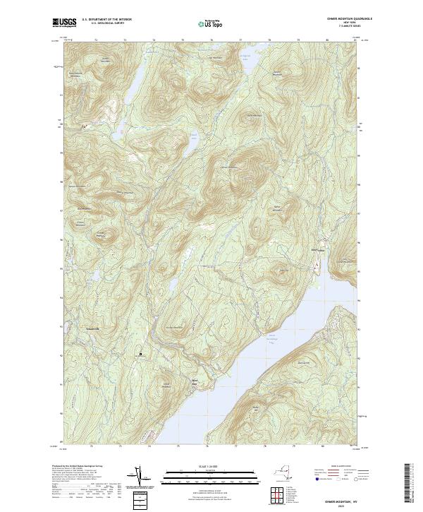
2023 Map of Ohmer Mountain
USGS Topo · Published 2023About this map
Great Sacandaga Lake dominates the southern landscape of this Saratoga County region, where the steep terrain of the Adirondacks meets the water's edge. The settlement of West Day sits along the shoreline, connected to the interior by roads such as Military Rd and Snow Rd. Further north, the landscape is defined by a dense concentration of summits including Ohmer Mountain, Slip Mountain, and Gene Edwards Mountain. This network of peaks is bisected by numerous drainages, most notably Tenant Creek and Sand Creek, which feed into local basins like Sand Lake and Bullhead Pond. Historically significant sites like the Edinburg Cem and the small community of Tenantville provide markers of early regional development. The eastern portion of the sheet features Day Center near the foot of Day Center Mountain, illustrating the traditional pattern of mountain-valley habitation.
Find a feature on this map
59 named features on this map. Tap any name to fly to it.
Don’t see what you’re looking for? This feature index may not catch every label — zoom into the map to look around manually.
Map Details
Editions of this 2023 Ohmer Mountain Map
This is the sole edition of this map. No revisions or reprints were ever made.
Other maps of this area

1899 · Broadalbin
USGS Topo · 1:62,500

1902 · Broadalbin
USGS Topo · 1:62,500

1902 · Saratoga
USGS Topo · 1:62,500

1903 · Luzerne
USGS Topo · 1:62,500

1910 · Stony Creek
USGS Topo · 1:62,500

1942 · Saratoga
USGS Topo · 1:62,500

1945 · Edinburg
USGS Topo · 1:24,000

1945 · Northville
USGS Topo · 1:24,000
1946 · Edinburg
USGS Topo · 1:24,000
1946 · Northville
USGS Topo · 1:24,000