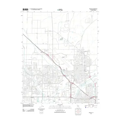
2012 Map of Oildale
USGS Topo · Published 2012About this map
Kern Front Oil Field and the Fruitvale Oil Field define the industrial character of this Kern County landscape north of Bakersfield. The terrain is a complex network of resource extraction and water management, featuring a dense grid of petroleum infrastructure alongside vital irrigation arteries like the Friant-Kern Canal, Beardsley Canal, and the Kern River. Regional transportation and aviation hubs are prominent, anchored by the Meadows Field Airport and the strategic Oil Junction.
Find a feature on this map
275 named features on this map. Tap any name to fly to it.
Don’t see what you’re looking for? This feature index may not catch every label — zoom into the map to look around manually.
Map Details
Editions of this 2012 Oildale Map
This is the sole edition of this map. No revisions or reprints were ever made.
Other maps of this area

1906 · Bakersfield
USGS Topo · 1:62,500

1910 · Buena Vista Lake
USGS Topo · 1:125,000

1912 · Buena Vista Lake
USGS Topo · 1:125,000

1914 · Caliente
USGS Topo · 1:125,000

1929 · Stevens
USGS Topo · 1:31,680

1929 · Fairfax School
USGS Topo · 1:31,680

1930 · Famoso
USGS Topo · 1:31,680

1930 · Rosedale
USGS Topo · 1:31,680

1930 · Oildale
USGS Topo · 1:31,680

1932 · North of Oildale
USGS Topo · 1:31,680