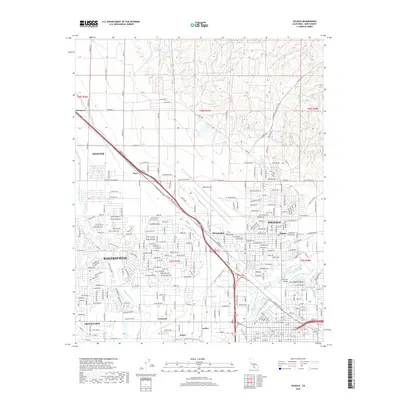
2018 Map of Oildale
USGS Topo · Published 2018About this map
Oildale and the northern reaches of Bakersfield dominate this landscape, illustrating the heavy industrial and agricultural footprint in the San Joaquin Valley. The map detail shows a complex network of water management systems critical to the region's development, including the Friant-Kern Canal, Beardsley Canal, and the Calloway Canal which flank the Kern River. This 2018 survey reveals the dense street grids of established neighborhoods like Fruitvale and Greenacres, contrasted with the specialized infrastructure at Meadows Field. Small, industry-linked rail points and settlements such as Oil Junction, Seguro, and Saco line the transportation corridors, marking the enduring connection between the local petroleum industry and the surrounding terrain. The presence of the Cross-Valley Canal Kern River further underscores the intricate hydraulic engineering required to support this desert-edge metropolitan area.
Find a feature on this map
270 named features on this map. Tap any name to fly to it.
Don’t see what you’re looking for? This feature index may not catch every label — zoom into the map to look around manually.
Map Details
Editions of this 2018 Oildale Map
This is the sole edition of this map. No revisions or reprints were ever made.
Other maps of this area

1906 · Bakersfield
USGS Topo · 1:62,500

1910 · Buena Vista Lake
USGS Topo · 1:125,000

1912 · Buena Vista Lake
USGS Topo · 1:125,000

1914 · Caliente
USGS Topo · 1:125,000

1929 · Stevens
USGS Topo · 1:31,680

1929 · Fairfax School
USGS Topo · 1:31,680

1930 · Famoso
USGS Topo · 1:31,680

1930 · Rosedale
USGS Topo · 1:31,680

1930 · Oildale
USGS Topo · 1:31,680

1932 · North of Oildale
USGS Topo · 1:31,680